Though we once almost lost sight of it, organizations like Lord Berkeley Conservation Trust help remind us that the essence of the Lowcountry still rides in the currents of the
Ashley River.
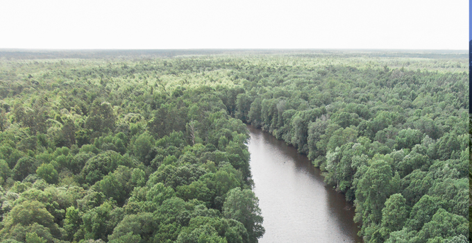
There was a time when the river was everything, and the Lowcountry moved to the rhythm of the Ashley River. Slow, straightforward, and stained by decaying vegetation to the deep, rich color of tea, its black water eased from the swamps before traveling the diverse landscape transforming it to a brackish river. Gathering speed and volume from the tributaries along the way, the river eventually surrendered to the influence of the sea, becoming flavored by the tides before flowing free into the wide world beyond its banks.
“Eventually, all things merge into one, and a river runs through it,” Norman McClean once wrote of a river that defined his life. In many ways, his words describe the Ashley River’s influence on the people and places it has touched for centuries on its journey to the sea. His words speak an indisputable truth that resonates with many, for the river has long carried with it the very essence of who we are. Along its banks, mighty oaks have lent shade to both those who rested and those who labored. On its rising tide, the world sailed to our doorstep. On its ebb tide, we, and the fruits of our labor were launched out into the world.
An age-old question asks of us, ‘How will our children know who they are if they don’t know where they come from?” The same might be asked of the Ashley River. To truly know it – to fully appreciate its contributions to our past, present, and future, we must understand where it comes from, and the significance of each mile of its journey.
The broad, saltwater river that leads to Charleston and the ocean beyond begins its journey to the sea some 60 miles upstream amidst the knobby knees of Berkeley and Dorchester Counties’ cypress trees. That often comes as a surprise to many, according to Chris Vaughn, Executive Director of Lord Berkeley Conservation Trust (LBCT). “Most think of the Ashley River only in terms of the stretch that runs from the historic plantations into Charleston. Even locals who have spent years on the Ashley River don’t realize that it doesn’t start right around the Highway 17A area in Dorchester County.”
But over 200 years ago, far upriver from the plantations that famously represent the Lowcountry, the community of Ridgeville, SC, and the rough-hewn cabins of Cypress Methodist Campground were strategically built on a ridge alongside Cypress Swamp – the highest point in the Ashley River’s headwaters. Berkeley County’s Wassamassaw Swamp and Dorchester County’s Cypress Swamp were both essential to early life in this region. Settlers here employed inland swamp rice-growing technology, a method largely overlooked in contrast to tidewater rice production. Remnants of dikes built to facilitate the grain’s growth are still evident in many areas.
Through the centuries, when asked, the river answered and served its people well. In addition to providing wild game and fish as a food source, the Ashley River also fed the fields where rice was cultivated, and provided access for barges and other vessels to carry the crop to world markets. As rice production declined in the years following the Civil War, the needs of the region changed. The Ashley once again answered, offering up the resources of its watershed.
Large tracts along the river were consolidated for commercial timber production. Vast deposits of phosphate-laden marl were discovered nearby, and docks began to dot the shoreline. At one time, the land along the Ashley River produced one-half of the world’s mined phosphate. But by 1938, the phosphate boom was over, and in its wake, a dramatic environmental bill was left to be paid. With devastatingly high phosphorus levels left behind, the generous river that had given us our identity was in danger of losing its own.
By mid-century, rather than surrender to the residual pollution, those who would see the river restored and revered for its historical, natural, and cultural contributions took note. More importantly, they began to take action. In 1976, under the South Carolina Scenic Rivers Act of 1974, the portion of the Ashley River from Summerville’s Bacon’s Bridge downstream to Bull’s Creek was declared eligible for designation as a State Scenic River.
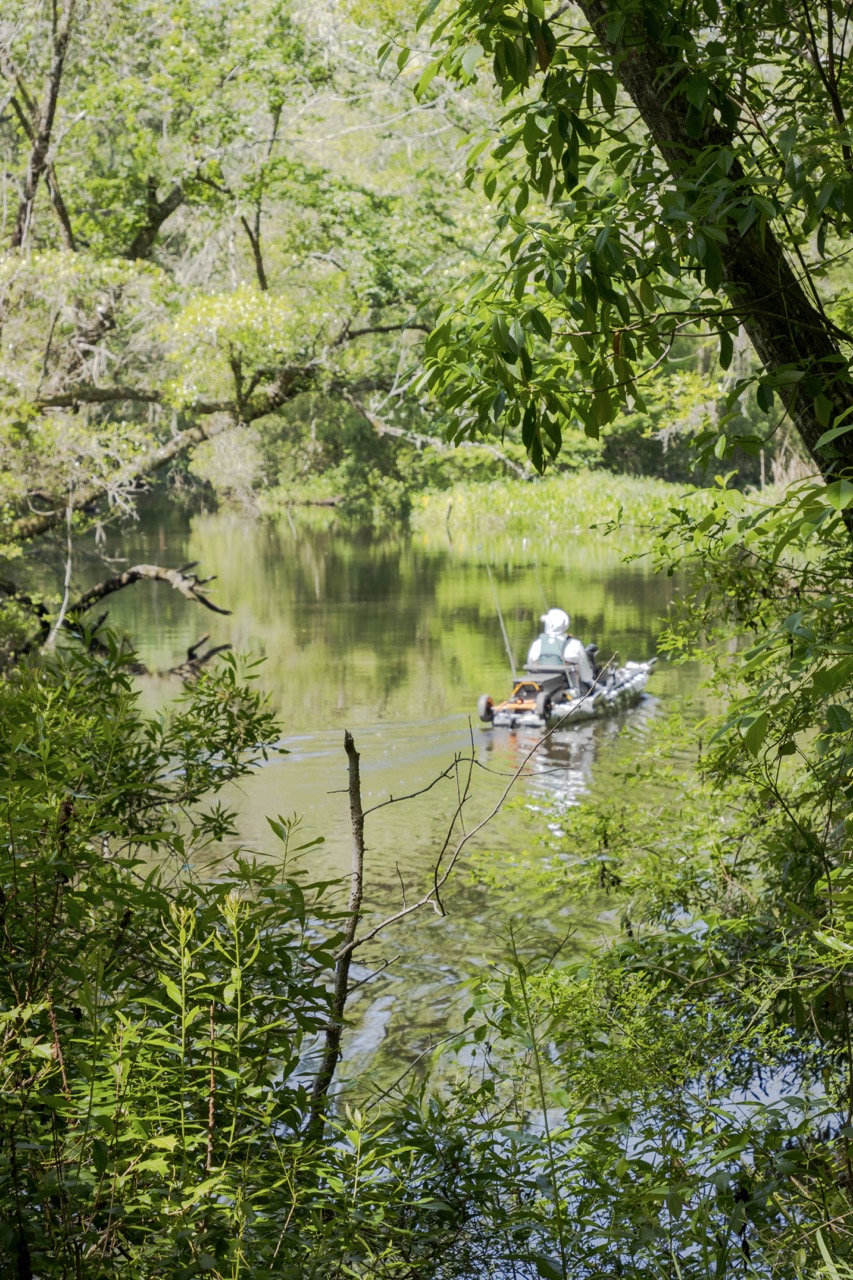
The tide continued to turn in the years just before the new millennium with the establishment of the Ashley Scenic River Council, and implementation of the Ashley River Management Plan. As the new century moved forward, in 2014, the Ashley River Blue Trail was created to help communities to explore the river through fishing, boating, and wildlife watching. As a result, the Blue Trail also increased recreation and tourism opportunities, adding local businesses and the economy in general while helping to protect river health and wildlife.
Today, due to the efforts of individuals, landowners, communities, local governments, and conservation organizations like LBCT, tremendous strides have been made. The Lowcountry’s unique resources and quality of life have led to its ranking as one of the most rapidly growing regions in the country.
Recently, along with like-minded organizations, LBCT was a participant in a project to conserve some of the last undeveloped waterfronts along the Ashley River and to restore wetlands in the King’s Grant development for a public park, walking trail and canoe and kayak launch owned and operated by the City of North Charleston.
But upstream, where the majority of the land along the headwaters is forested, farmed, or serves as wildlife habitat, the Ashley River is not protected, leaving it particularly vulnerable to development pressures from both east and west. For LBCT, founded in 1992 to help permanently conserve environmentally and historically sensitive lands within a nine-county region bordering Berkeley County, the area is of critical importance.
“Of all the areas LBCT works, the Ashley River Headwaters is perhaps the most threatened of all due to its proximity to I-26 and to several large industrial developments,” says Vaughn, “Land use in the headwaters impacts every community downstream. Urban growth in this region is unavoidable, but wisely planned growth will help every community along the Ashely River corridor to connect with the river in the most positive ways, and to develop a vision for what it should look like in the future.”
This year, along with Weyerhaeuser, LBCT announced the permanent protection and restoration of Big Run. With 2,485 acres and six miles of braided streams in Berkeley County, Big Run contains critical wetlands within the Ashley River’s headwaters. It is part of a larger conservation initiative to create a greenbelt around the Charleston Metro area.
Extending from the Ashley River at Charleston Harbor, the Big Run parcel evolves upstream into Cypress Swamp, then into the braided stream system of Big Run Creek, before ending at the southern edge of Lake Moultrie. To date, Lord Berkeley Conservation Trust has protected more than 40,000 acres permanently through easements and acquisitions. The easement serves as an anchor that will hopefully be a catalyst for additional land protection along the headwaters.
“These kinds of cooperative efforts and this type of wise land management are the key to preserving a positive future for the Ashley River, and others like it,” says Vaughn. “The cost of doing nothing is simply unacceptable.”
If we are wise, the very essence of South Carolina will continue to be carried into the future on the clear waters of an outgoing tide that will once again tell the world who we are and what we value. The river is everything to the rhythm of the Lowcountry, and although we may have at one time lost sight of that, Lord Berkeley Conservation Trust and others like it have reminded us of the words are as relevant today as they were when we first saw the sunlight on the Ashley: “Eventually, all things merge into one, and a river runs through it.”
by Susan Frampton


